
Presentations and Documents

Presentations
Background Information
Regulatory Oversight
Cleanup Information
Remedial Actions and Operations & Maintenance
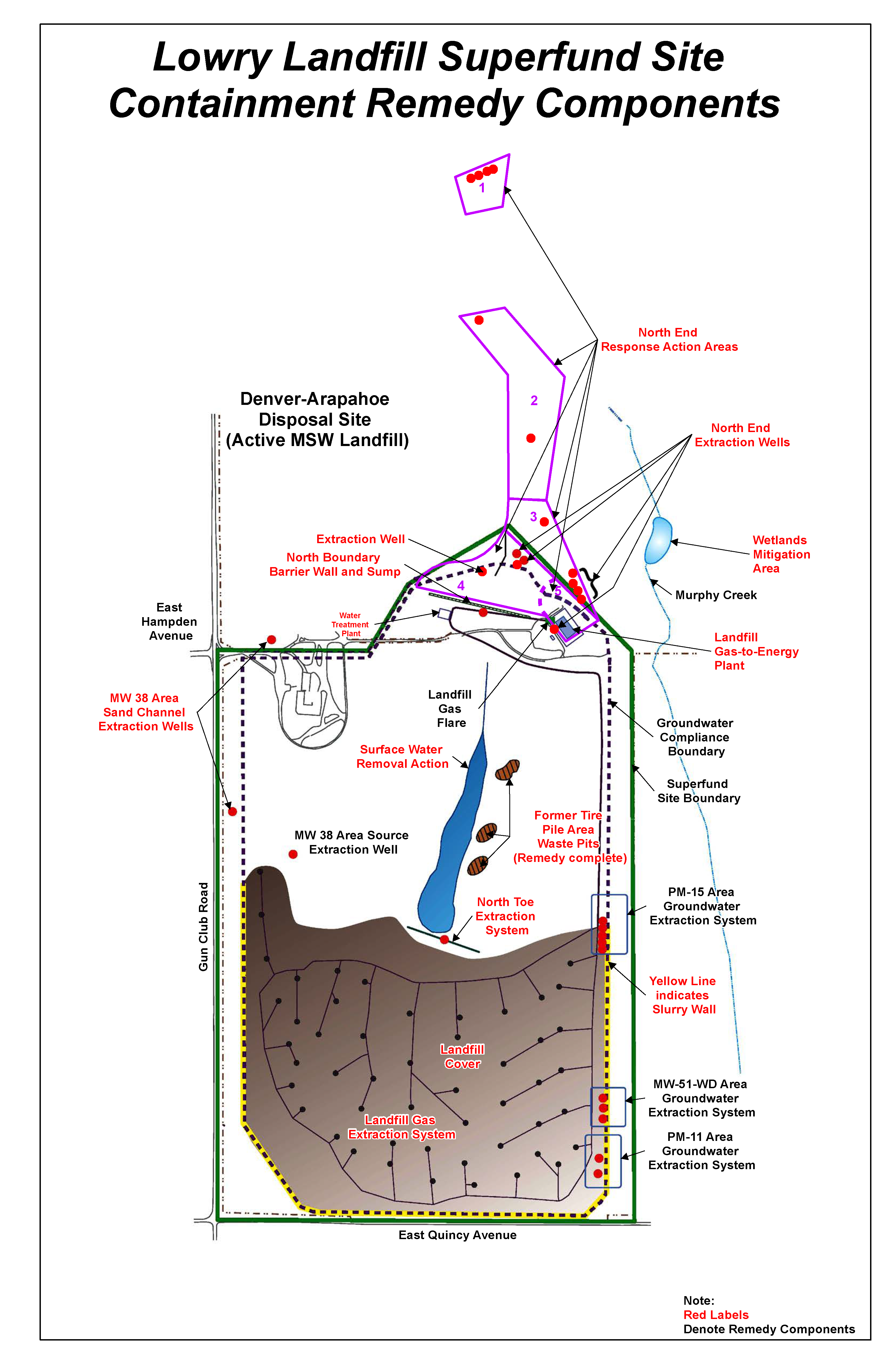
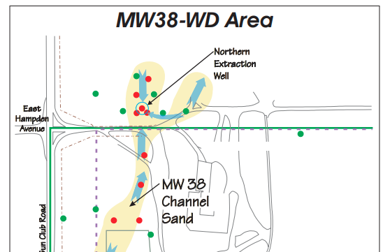
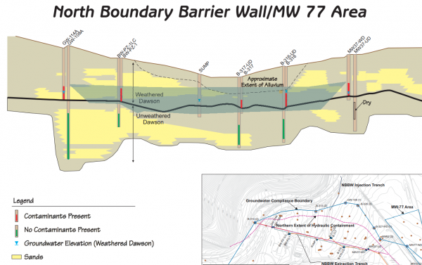
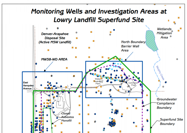
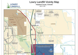
Maps & Graphics

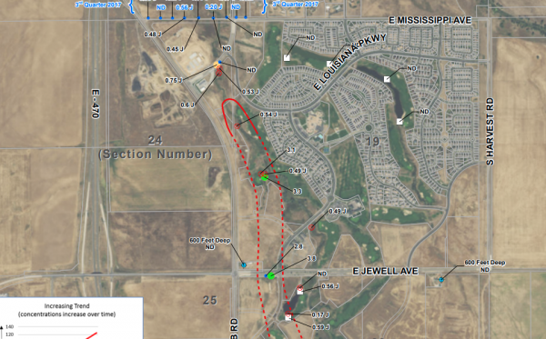
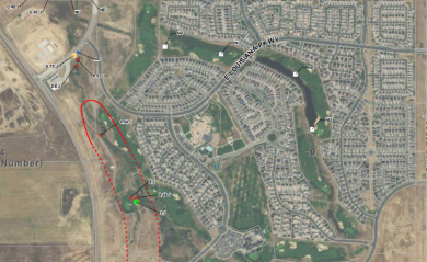
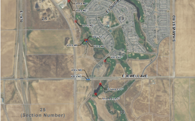
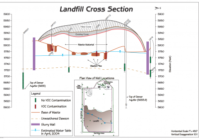
Review these visual aides to get a better feel for Lowry Landfill’s location and layout. Produced in collaboration with the U.S. Environmental Protection Agency, the Colorado Department of Public Health and Environment, and the Tri-County Health Department, they’re your eyes’ guide to cleanup efforts and achievements.
Interactive Water Map

North End Monitoring Results:
Other Graphics:
Helpful Links

Cleanup at Lowry Landfill is a public-private partnership between regulatory agencies, local governments, and private entities. In addition to this website which is maintained by the City and County of Denver and Waste Management of Colorado—citizens who are interested in learning more about Lowry Landfill can consult the following websites maintained by our partner organizations or contact the agencies directly:
- U.S. Environmental Protection Agency – Lowry Landfill Page: The U.S. Environmental Protection Agency’s Lowry Landfill page includes a complete history of the Lowry Landfill Site, a description of cleanup efforts and achievements, and a repository of site-related documents.
- Colorado Department of Public Health and Environment – Lowry Landfill Page: The Colorado Department of Public Health and Environment maintains a Lowry Landfill web page that includes a Site summary, a description of environmental concerns, and an overview of current activity.
- Arapahoe County Public Health: Arapahoe County Public Health serves the residents across Arapahoe County with information about public health and environmental concerns.